About: Beacon Hill, Sedgley Goto Sponge NotDistinct Permalink
An Entity of Type : dbo:Mountain,
within Data Space : dbpedia.org associated with source document(s)

![http://dbpedia.org/describe/?url=http%3A%2F%2Fdbpedia.org%2Fresource%2FBeacon_Hill%2C_Sedgley]()

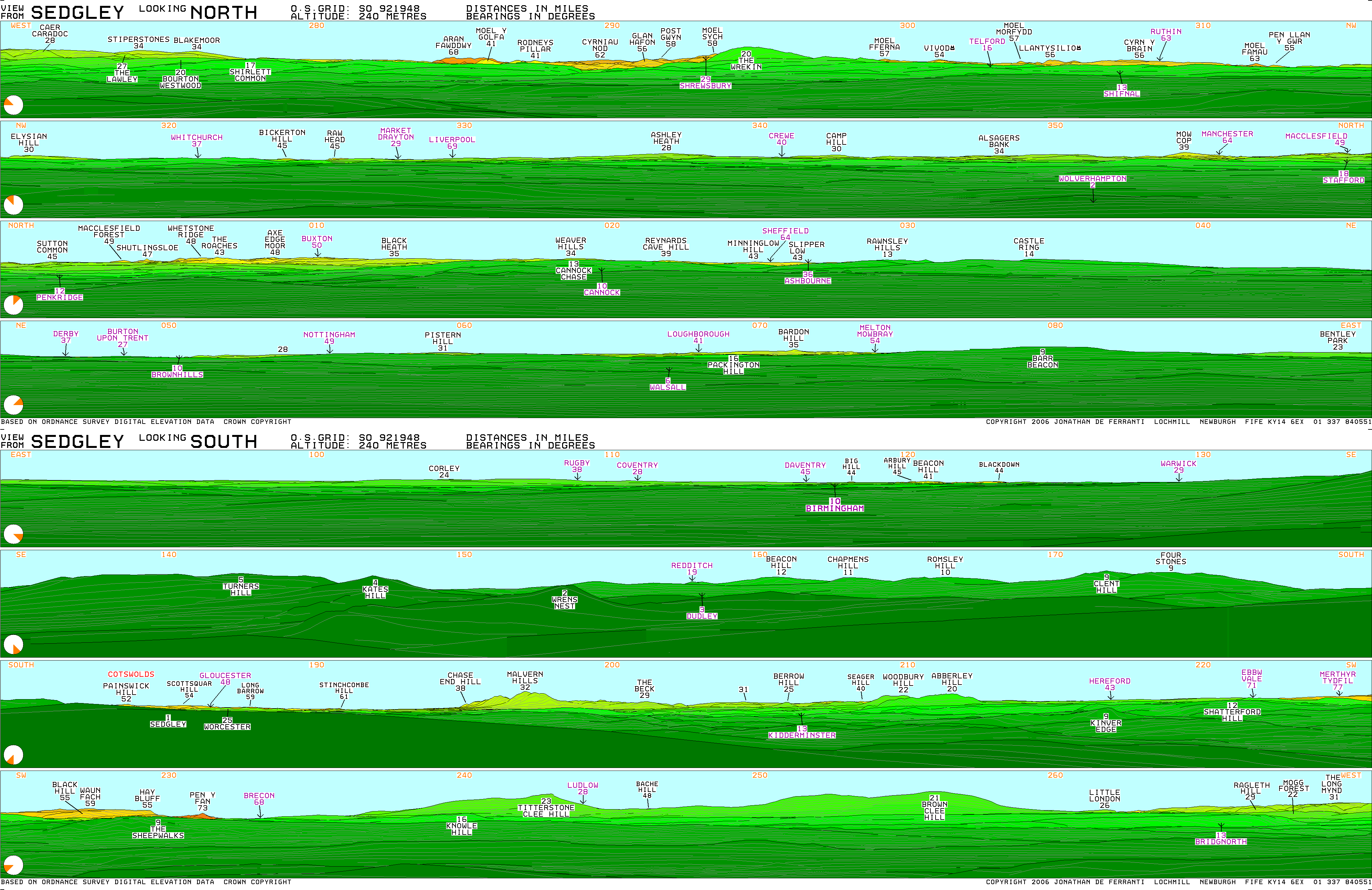
Beacon Hill in Sedgley, England, is one of the highest points in the West Midlands, at 237 metres (778 ft) above sea level. From the summit, Wolverhampton, Walsall and Birmingham are all visible, as is the Staffordshire, Shropshire and Welsh countryside to the west. The hill is so named as historically it was one in a series of prominent locations with beacons on top, where a fire would be lit as a signal during times of war or turmoil. The Sedgley beacon lies between beacons at Barr Beacon and Cannock Chase. At the highest point, a Grade II listed tower erected in 1846 by Lord Wrottesley for astronomy, stands on the site of an earlier tower, which sits on the spot of the original beacon.
| Attributes | Values |
|---|---|
| rdf:type |
|
| rdfs:label |
|
| rdfs:comment |
|
| foaf:name |
|
| name |
|
| geo:lat |
|
| geo:long |
|
| foaf:depiction | |
| dcterms:subject | |
| Wikipage page ID |
|
| Wikipage revision ID |
|
| Link from a Wikipage to another Wikipage |
|
| Link from a Wikipage to an external page | |
| sameAs | |
| dbp:wikiPageUsesTemplate | |
| thumbnail | |
| elevation m |
|
| location | |
| photo |
|
| photo caption |
|
| georss:point |
|
| has abstract |
|
| gold:hypernym | |
| prov:wasDerivedFrom | |
| page length (characters) of wiki page |
|
| elevation (μ) |
|
| located in area | |
| foaf:isPrimaryTopicOf | |
| geo:geometry |
|
| is Link from a Wikipage to another Wikipage of | |
| is Wikipage disambiguates of | |
| is foaf:primaryTopic of |
Faceted Search & Find service v1.17_git139 as of Feb 29 2024


![[RDF Data]](/fct/images/sw-rdf-blue.png)

OpenLink Virtuoso version 08.03.3330 as of Mar 19 2024, on Linux (x86_64-generic-linux-glibc212), Single-Server Edition (61 GB total memory, 51 GB memory in use)
Data on this page belongs to its respective rights holders.
Virtuoso Faceted Browser Copyright © 2009-2024 OpenLink Software


![[RDF Data]](/fct/images/sw-rdf-blue.png)
OpenLink Virtuoso version 08.03.3330 as of Mar 19 2024, on Linux (x86_64-generic-linux-glibc212), Single-Server Edition (61 GB total memory, 51 GB memory in use)
Data on this page belongs to its respective rights holders.
Virtuoso Faceted Browser Copyright © 2009-2024 OpenLink Software


![[cxml]](/fct/images/cxml_doc.png)
![[csv]](/fct/images/csv_doc.png)
![[text]](/fct/images/ntriples_doc.png)
![[turtle]](/fct/images/n3turtle_doc.png)
![[ld+json]](/fct/images/jsonld_doc.png)
![[rdf+json]](/fct/images/json_doc.png)
![[rdf+xml]](/fct/images/xml_doc.png)
![[atom+xml]](/fct/images/atom_doc.png)
![[html]](/fct/images/html_doc.png)